Tuesday, 28 June 2022
ACTION GROUP 2
OUTDOORS AND NATURE BRIEFING NOTE
1 PLAYPARKS - We have established what support is available from the local authority on playpark development and management of the playparks with an idea to develop one at Wildside
2 PATHS AND PLACES - We are referred to in the Forestry Land Scotland consultation as a partner here – perhaps you’d like to comment on their proposals Communities - Forestry and Land Scotland
Graeme Ambrose and Nick Wright did some work on paths. Details below. An action from todays meeting would be to get a team of volunteers together to take these findings forward and to work on them.
Graeme suggested a way forward would be
Paths & Places
Requirements of an audit of the existing paths and places of interest en route:
- Name of path(trail) if one exists
- Location, start /finish points, length and whether-or-not the path extends beyond the boundaries of the Stratherrick & Foyers area
- Is the path primarily for
a) walkers
b) cyclists
c) horse riders
d) all of the above
- Is the path a built path? If so to what standard (materials used, width etc) and by whom
- Is the path suitable for those with restricted mobility?
- If it is not a built path is it
b) forest road
c) right of way
d) ‘unofficial’ path developed by people as a shortcut from a to b,
e) a mixture of some or all of these
- Is the path part of a wider path/trail network? e.g. the South Loch Ness Trail/the Loch Ness 360
- Who if anyone is presently responsible for maintenance of the path?
a) Highland Council (as part of the core path network)
b) Forestry and Land
c) Landowner
d) Visit InvernessLochNess (VILN)
e) multiple organisations
f) not known
- If the organisation responsible is known, when was the last known time that any maintenance was carried out and what was done?
- Where the path is the responsibility of one overarching organisation are there any agreements in place between itself and landowners/other organisations
- What is the condition of the path
a) excellent
b) good
c) poor
d) a mixture of these ?
- Where the condition is poor, what makes it poor e.g. boggy, no use for cyclists, overgrown etc.
- Does the path have signage? If so is it
a) excellent
b) good
c) poor
d) n/a
- Does the path have any information boards/lecterns/monoliths along the route? If so where and what condition are these in?
- Where no information exists are there points of interest relating to heritage, flora and fauna along the path?
- Does the path have any viewpoints? If so what conditions are these in (i.e. do they have a view or is it all overgrown, is there a bench/table at the viewpoint)
- Are there any points on the path where the footfall is presently recorded? (e.g. on the SLNT). If so, are numbers available?
- Who are the main path users
a) locals
b) visitors
c) a mixture of both
- Is the path actively marketed? If so by whom?
- Are there any locations where presently there is no path, that the construction of a new path would be of benefit to the community socially and economically?
The audit, assuming it is comprehensive, would then enable prioritisation of paths for investment and development.
Nick Wright did some work based on this
I thought the most useful thing I could do was to start with where people actually walk now, using Strava walking data. So, I've put together an editable Google Map, which is based on Strava heatmap data for walking:
https://www.google.com/maps/d/edit?mid=1bVFzi9QtBFsEBp9WO1OCqU2SDcE6yoxD&usp=sharing
For me, this gives the starting point for thinking about a network around the whole area (or a series of linked mini-networks based around each settlement, depending on your point of view).
But to get to that point, some local knowledge is needed about which routes should be the focus. That could be through the paths audit that Graeme and others suggested in the working group last year (more detail here, particularly in the diagram or video), and for which Graeme fleshed out criteria last month.
That of course needs volunteers, or money to pay someone to do it; if neither of those are available.
I've added another layer to the Google Map, showing off-road cycle routes from Strava data, as you suggested Graeme:
https://www.google.com/maps/d/edit?mid=1bVFzi9QtBFsEBp9WO1OCqU2SDcE6yoxD&usp=sharing
It's interesting to see exactly where the routes go up into the Monadhliath, using windfarm tracks - there are two quite big loops.
Graeme suggested some QUICK WINS although the group may want to have an overall approach too.
Possible Path ‘quick wins’
- Between Whitebridge & Foyers on South Loch Ness Trail: There are two stream crossings both of which regularly rise in level in wet weather and make crossing almost impossible without getting wet feet. By simply laying in some large stepping stones this issue would at least be negated. The crossings are on Dell Estate but the route is also I think, a Right of Way
- Between Foyers & Inverfarigaig on the South Loch Ness Trail: There is a short section through dense wood and out over a small boggy area which has long been in need of upgrading. It is on a section of the trail that is popular both with locals and visitors and is getting steadily worse, particularly as more bikers are now using it. The work required is largely the clearing of branches, improvement of signage in the woods, filling in the wet areas with large stones and defining the path more clearly through the woods. This may seem quite a lot to do but it should be relatively simple. I think it is on F&L land but it is also core path for which Highland Council have responsibility and Visit InvernessLochNess who established the trail, have a responsibility for the signage.
- Between Foyers and Inverfarigaig: Part of the ‘low route’ near to the SSE sub- station. This has I think previously been maintained by F&L but not for a very long time. Despite this it remains popular with walkers as a return route to Foyers from Inverfarigaig or vice versa. The section requiring attended to has suffered recently from fallen trees during the storms. Last time I looked a path had already been cut through them but with a bit more work and tidying up it can be quickly restored to a decent standard.
- Link path between the Trinloist forest road down to Glenlia: This track was ruined when F&L felled in Glenlia a few years ago. It was made semi useable again but could do with some tlc, redefining the path in places and reducing the gradient of the path, placing stones over wet areas plus resurrecting signage. Again, I think this is part of a core path. As far as I am aware there are no plans as yet by F&L to fell the remaining trees in Glenlia.
- Link path from near Foyers Medical centre up to the Craigdarroch Hotel: Used by locals and visitors staying at the caravan park. I am not familiar with this path but I believe that it simply requires the cutting back of undergrowth to make it more accessible. If this is the case it would be a very quick win.
- Link path off South Loch Ness Trail beyond Easter Boleskine that connects down to Glenlia. This was previously maintained by F&L but was abandoned by them a few years ago. For the most part it is in a good state as they spread wood chippings not so long ago, but it would benefit from some signage at both ends indicating the link that it provides and secondly rubble to fill in a small area which is becoming very boggy. At present, this area is simply getting steadily larger and worse as more people try to avoid it.
Paths meeting suggested at Wildside Centre on Wed 6th July at 12 noon.
- Get paths audit group up and running with Graeme's 2-3 other suggested local contacts (hybrid mtg in Wildside/online Wednesday 6th July lunchtime, or feed in via email)
- If there's a role for Boleskine House to get involved with paths around them, they're ready and waiting
- Contact Ruaridh to understand FLS forthcoming activities and re-establish contact with Becky (invite her to the next action group meeting?). They will help and should be sent ‘quick wins’ document to advise on that.
- Community woodland - leave for now
- Playparks - rolling programme. The options presented by Kirsty were explained. General support but most people at meeting for Pathways etc. Perhaps move to Community Life (?) and engage directly with Baby and Toddlers, Schools, Youth Club and childcare group (who mentioned decline in playparks as an issue
- 2026
- June (14 stories)
-
23 June
🚨 Final week to complete the reCAP survey!
 There's still time to have your say on the future of our community. The updated Community Action Plan will help shape priorities and guide future community benefit...
 -
22 June
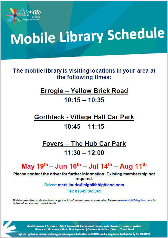
📚 Mobile Library Visiting This Wednesday
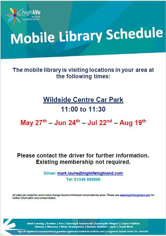 The Mobile Library will be in Whitebridge this Wednesday morning, so pop along and say hello to Mark! 📍 Stopping point & time: • Whitebridge &ndas...
 -
18 June
The reCAP survey closes on the 30th of June.
 The reCAP survey closes on the 30th of June. This is your opportunity to help shape future priorities for our community and influence how community benefit f...
 -
17 June
🎭✨ A Night at the Musicals – This Friday! ✨🎭
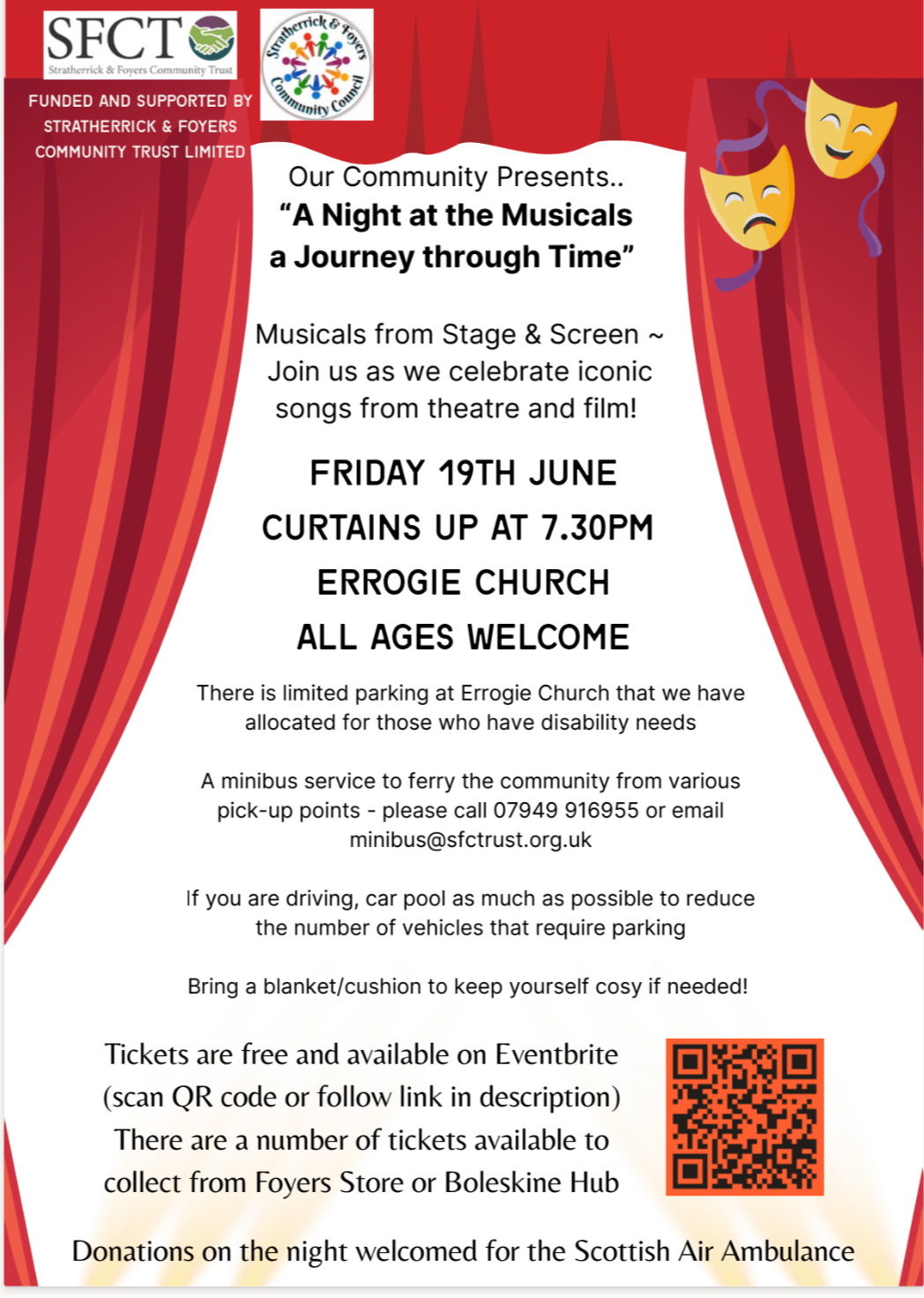 Join Sing In The Strath for their very first concert, “A Night at the Musicals – A Journey Through Time”, celebrating iconic songs from stage and screen...
 -
17 June
Animals at The Wildside Centre
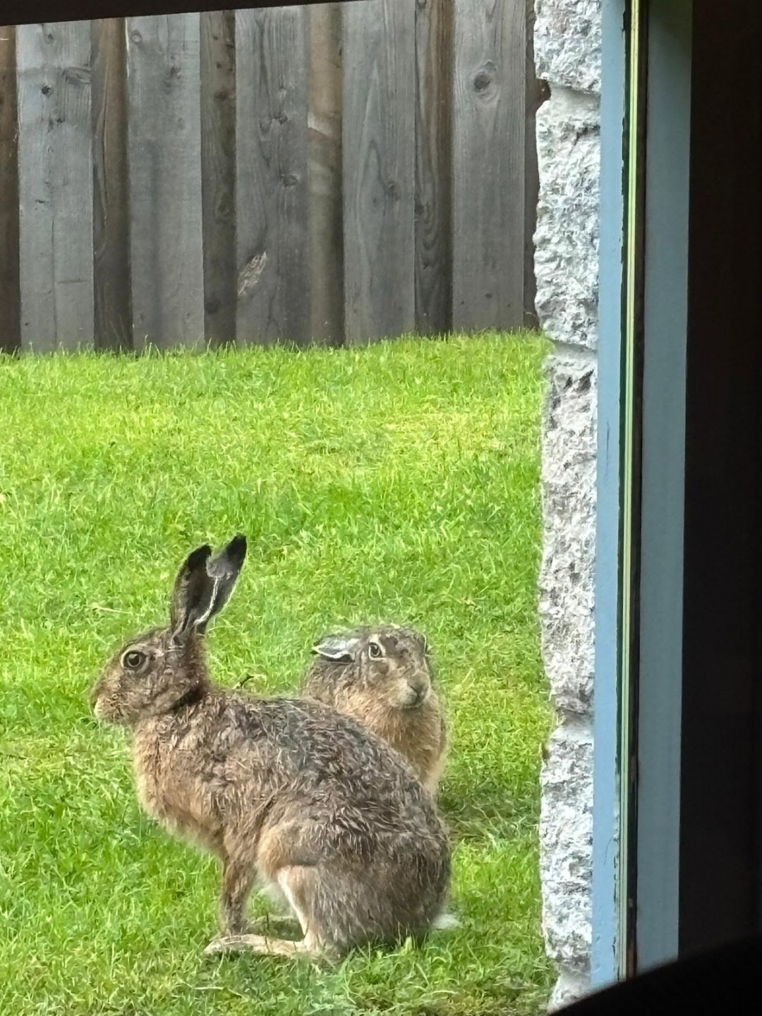 We are delighted that the Wildside Centre has been visited by so many furry friends this year, and the play park continues to entertain our younger members. So with respe...
 -
16 June
🎻 Traditional Music Session – Everyone Welcome! 🎶
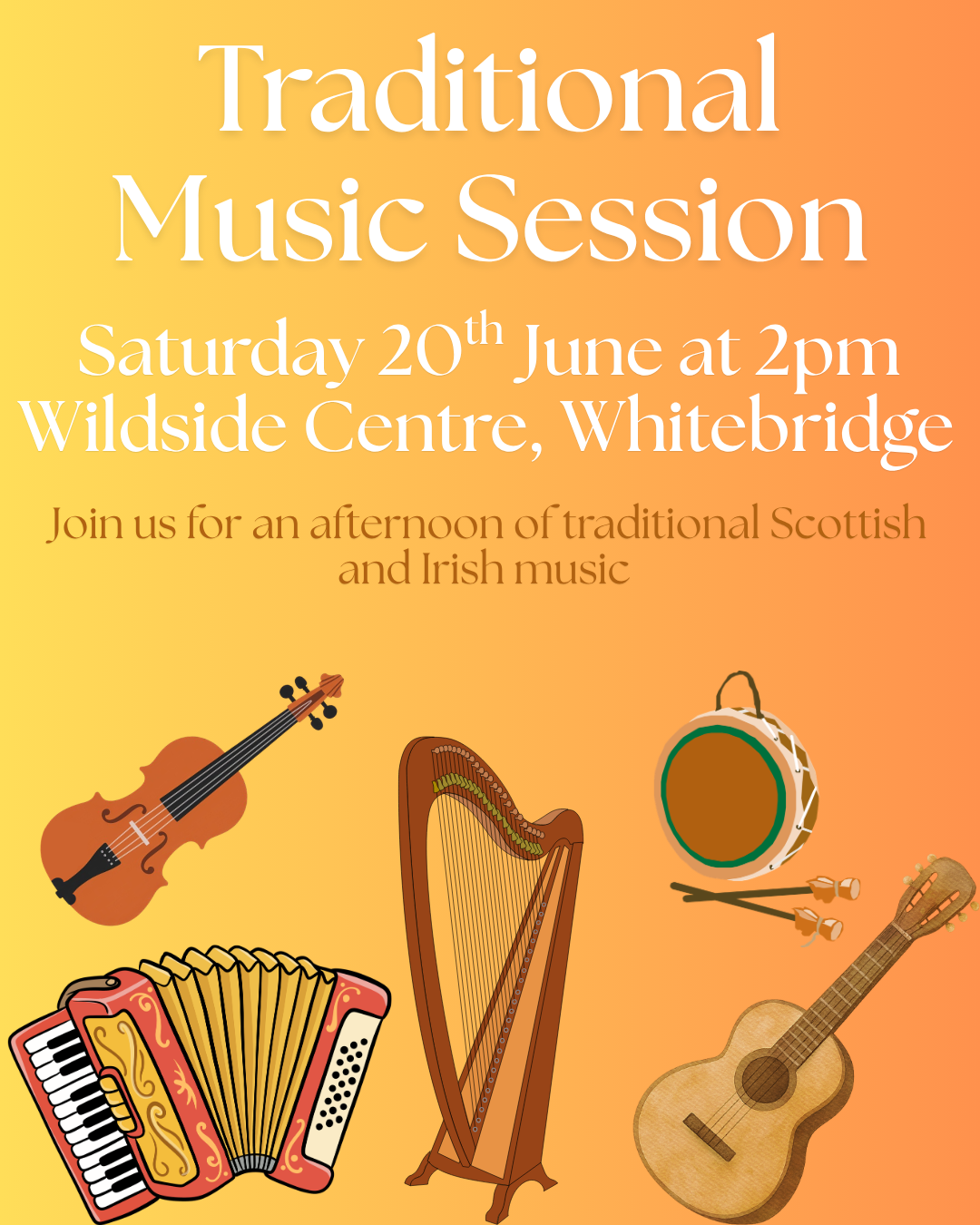 Love traditional music? Come along and join Kirsteen & Jack at The Wildside Centre on Saturday 20th June from 2pm for an afternoon of tunes, music, and great company....
 -
12 June
📚 Mobile Library Visiting Next Week - 16th June! 🚐✨
 The Mobile Library will be in the area next Tuesday morning, so pop along and say hello to Mark! 📍 Stopping points & times: • Errogie ...
 -
11 June
South Loch Ness Heritage Group Visit Brora & Helmsdale with the Community Minibus
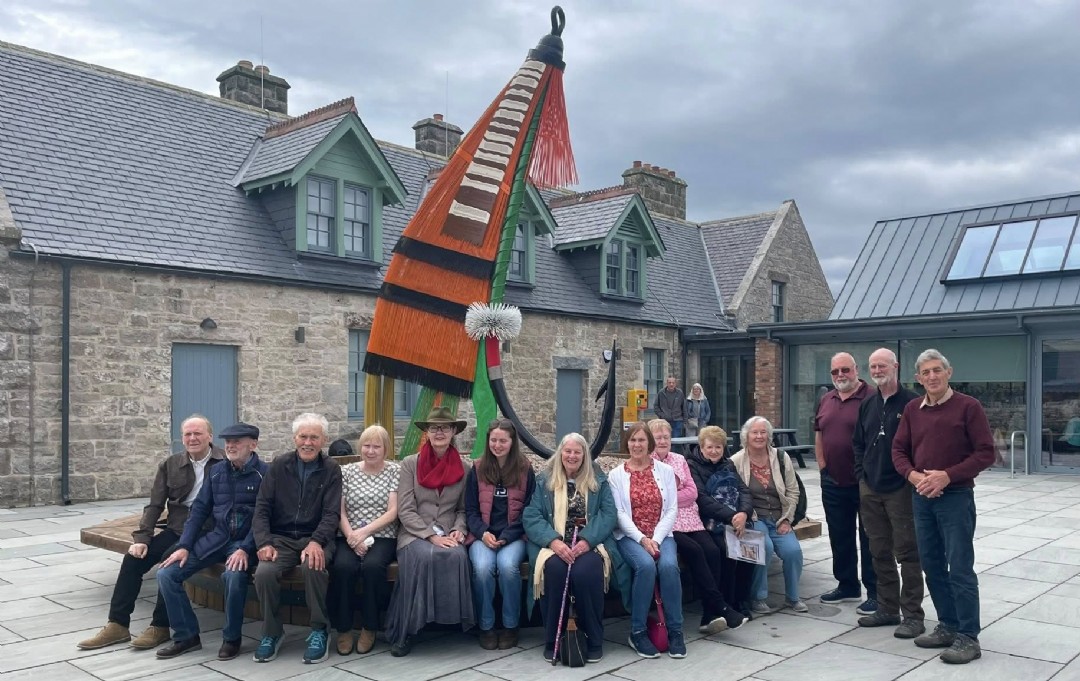 On Saturday 6th June, the Stratherrick & Foyers Community Trust Community Minibus helped the South Loch Ness Heritage Group travel to the north of the Highlands for a...
 -
10 June
The South Loch Ness Swift Project
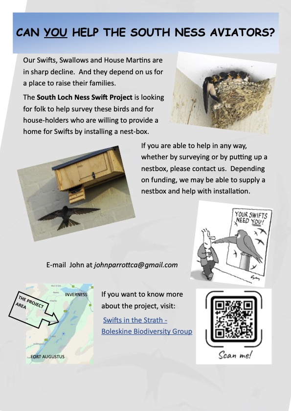 The South Loch Ness Swift Project is looking for folk to help survey these birds and for house-holders who are willing to provide a home for Swifts by installing a nest-b...
 -
9 June
⏰ Have you completed the reCAP survey yet?
The Community Action Plan has helped guide local priorities over the last five years, but now we need your views on what should happen next. Whether you'...
-
8 June
☕ Fancy a coffee and a catch-up?
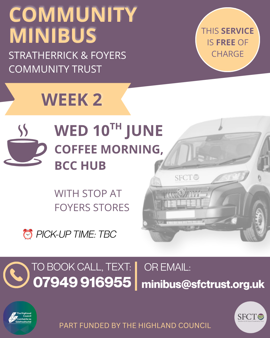 Join BCC on Wednesday 10th June for a Coffee Morning at the Hub, with a stop at Foyers Stores. ✅ Free transport ✅ Advance booking required ✅ Friendly c...
 -
3 June
Grants Deadline - June 21
 🚨 Don’t miss out! 🚨 There’s still time to apply for our latest round of grant funding - but be quick! The deadline is the 21st of June ⏳ Got a project...
 -
1 June
📢 reCAP – Refreshing the Community Action Plan
 Back in 2021, the Community Action Plan (CAP) was created to help guide what we as a community would focus on over five years - including how to make the best use of the ...
 -
1 June
🚐 Community Minibus Trips – June 2026 🚐
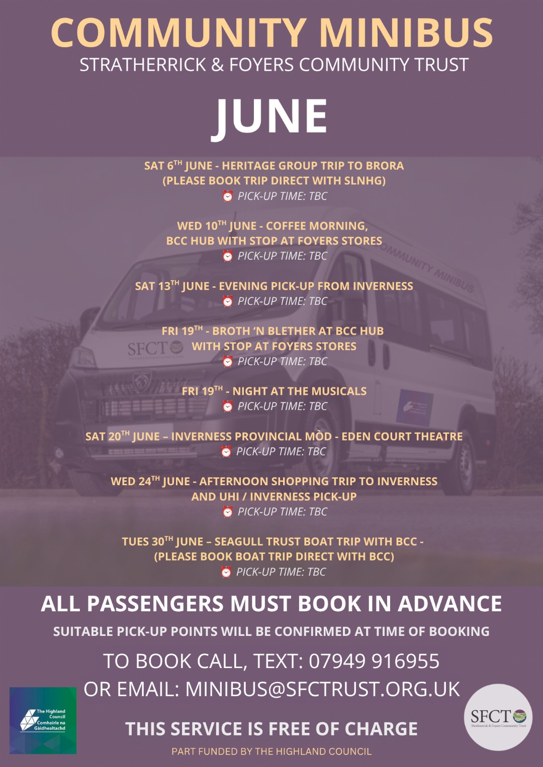 We’re delighted to continue offering our FREE Community Minibus Trips, helping local people stay connected, access services, and enjoy days out in the community. ...
 - May (11 stories)
-
29 May
reCAP - Coming June 1st.

-
28 May
Community Minibus - Drivers Wanted
 We are on the lookout for new drivers to help keep up with the demand of our popular Community Minibus scheme. Since our new minibus was secured back in March, w...
 -
27 May
🎭 Calling all musical lovers! 🎶
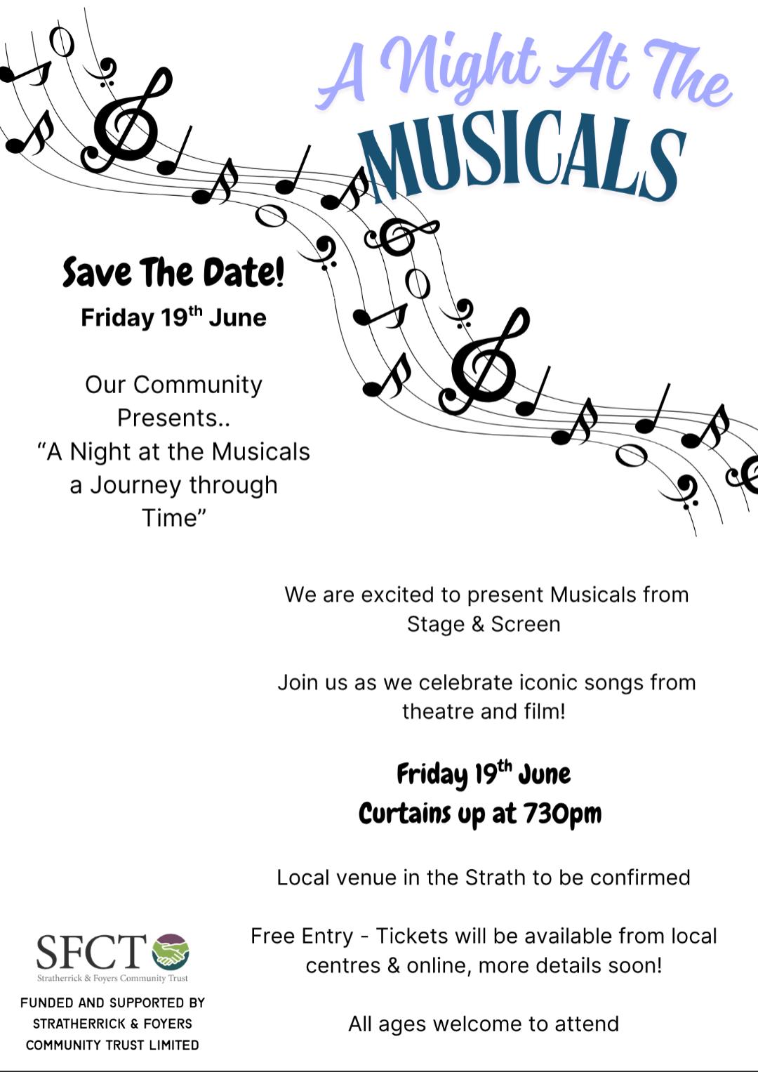 Sing In The Strath are holding their very first concert on the 19th June - and if you’re a fan of musicals, this is definitely for you! Join the group ...
 -
20 May
Mobile Library - Wed 27th at The Wildside Centre
The Mobile Library will be back at The Wildside Centre a week today! Why not pop by say hello to Mark, the fantastic librarian and browse the selection of books availa...
-
18 May
🎉 Exciting news from the Errogie Church Community and Culture Group
 An exciting update from the Errogie Church Community and Culture Group We are pleased to say that the doors to Errogie Old Church will shortly be openin...
 -
18 May
📚 Mobile Library Visiting Tomorrow – 19th May! 🚐✨
The Mobile Library will be in the area tomorrow morning, so pop along and say hello to Mark! 📍 Stopping points & times: • Errogie – Yellow B...
-
13 May
Become A Member
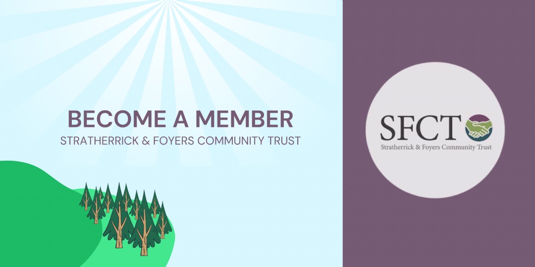 We encourage every person living in the community to become a Member of the Trust. It’s free to join and gives you the opportunity to influence how the company is r...
 -
12 May
Traditional Music Session - 16th May
 Looking for a fix of traditional Scottish tunes? Why not head along to the Wildside Centre this Saturday from 2pm, where Kirsteen & Jack return wit...
 -
6 May
🚐 Community Minibus Trips for May! 🎉
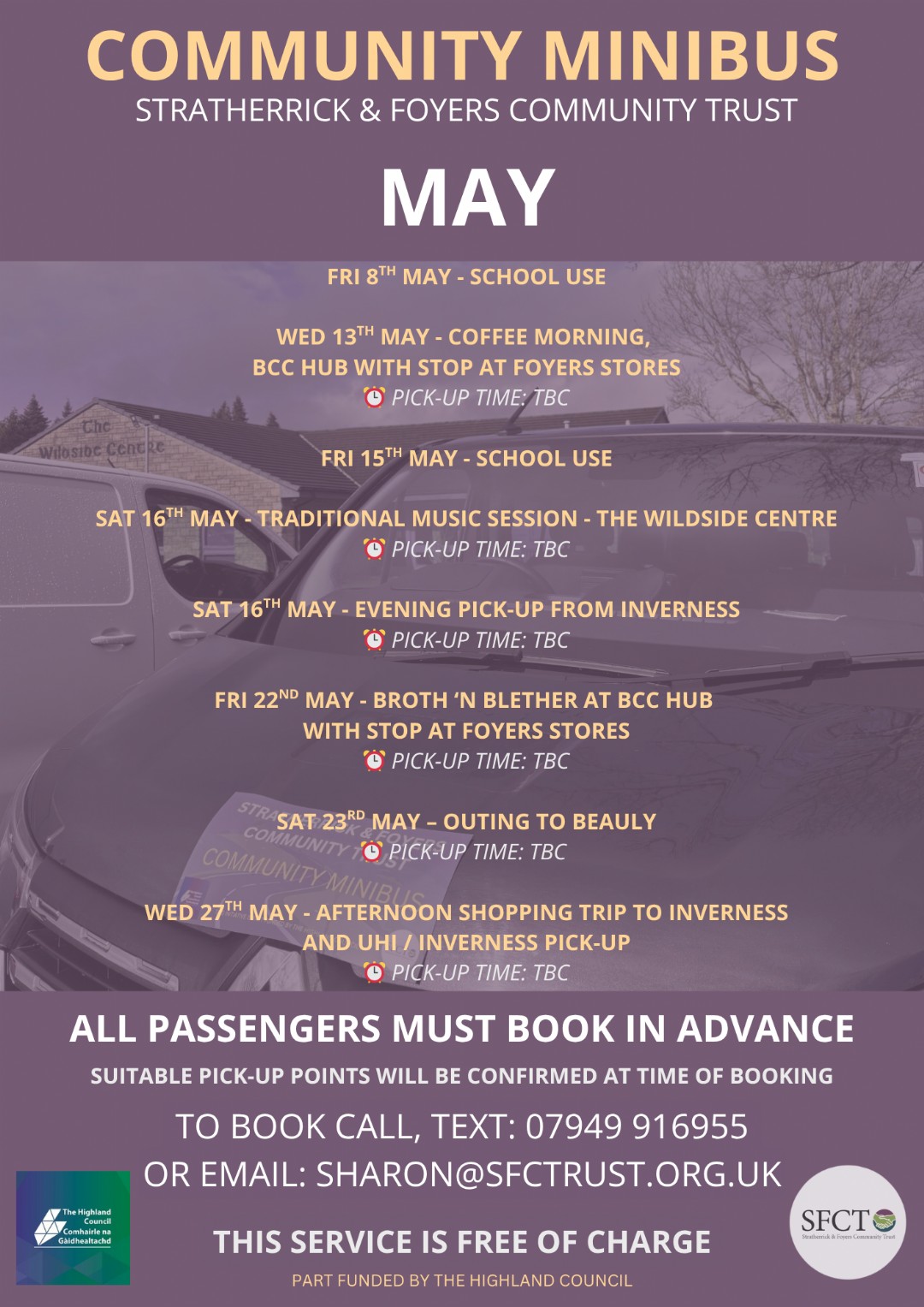 We’re really pleased to be able to offer our Community Minibus trips again this May, and we continue to hear just how valuable they are to local people 💙 ...
 -
5 May
Thank you from SFCC & SFCT
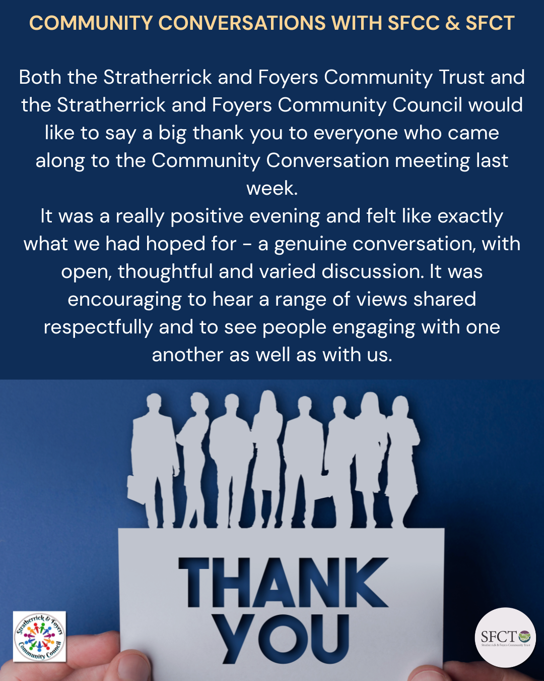 Both the Stratherrick and Foyers Community Trust and the Stratherrick and Foyers Community Council would like to say a big thank you to everyone who came along to the Com...
 -
1 May
Ultra X - 2nd & 3rd May - (This weekend)
 Reminder that Ultra X is taking place this weekend - (2nd/3rd May). The group will be utilising the Wildside Centre, Inverfarigaig Centre and Foyers Bay Compound. &nbs...
 - April (11 stories)
-
30 April
Family Ceilidh - Sunday 3rd May
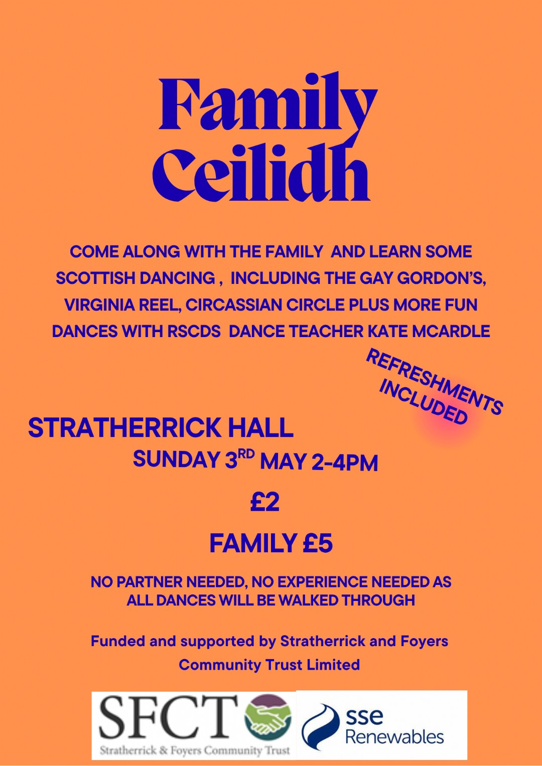 Head along for a fun-filled Family Ceilidh at Stratherrick Public Hall this Sunday, 3rd of May from 2–4pm! 💃🕺 Enjoy an afternoon of Scottish dancing ...
 -
29 April
Agenda for tonight's joint meeting with SFCC & SFCT
 Community Conversations with Stratherrick & Foyers Community Council & Stratherrick & Foyers Community Trust Tonight - 29th April, 7pm at The Wil...
 -
29 April
Etape Success - Record numbers at Wildside!
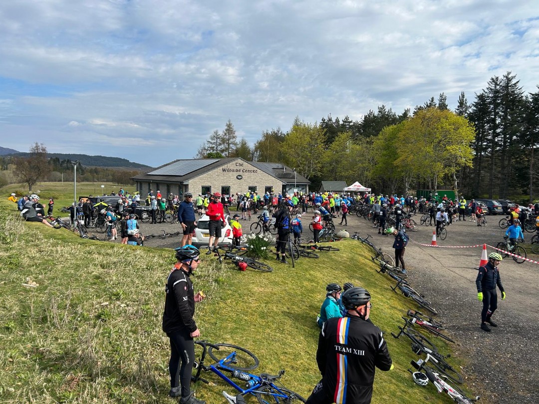 Just in case anyone was wondering what on earth was happening, last Sunday saw the cycling event “Etape Loch Ness” visit our area. You may know that the event...
 -
24 April
Highland Gathering Update 2026
 We wanted to let everyone know that we won’t be holding the Gathering this year. This decision was not taken lightly. It reflects the need to make some cost sa...
 -
22 April
Foyers Field Update
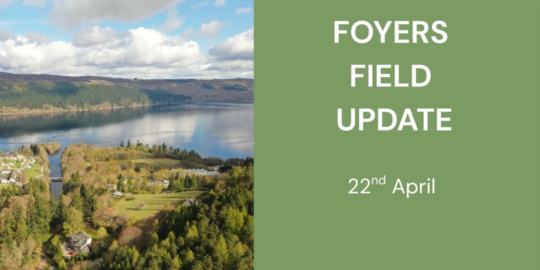 We would like to provide a wider community update on the field in Lower Foyers owned by SFCT, is currently being re-explored for possible future community use. Throughout...
 -
13 April
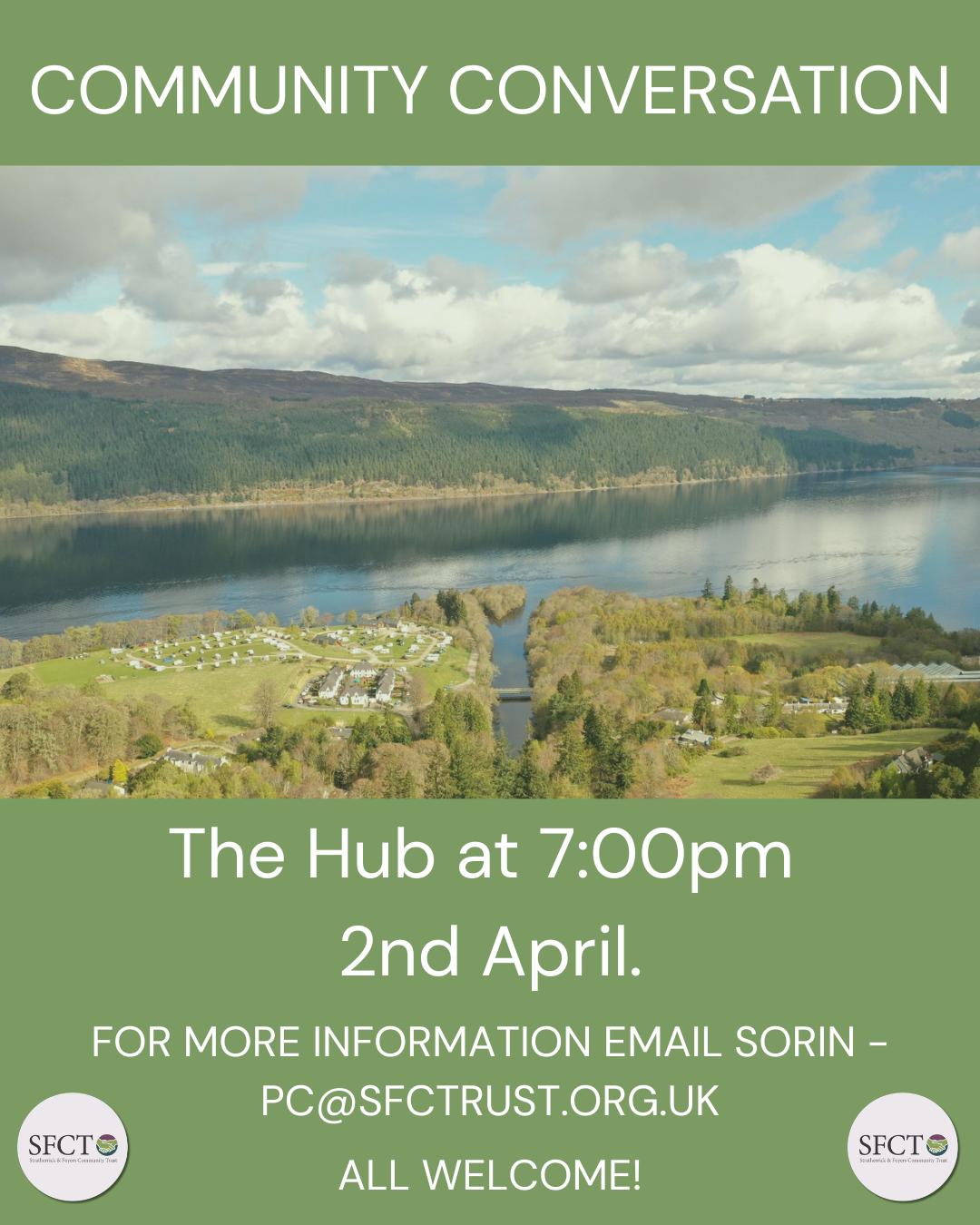
Community Conversations with SFCC & SFCT
Following joint working between Stratherrick & Foyers Community Trust (SFCT) and Stratherrick & Foyers Community Council (SFCC), we are launching a series of Comm...
-
8 April
Community Leisure Steering Group - 15th April
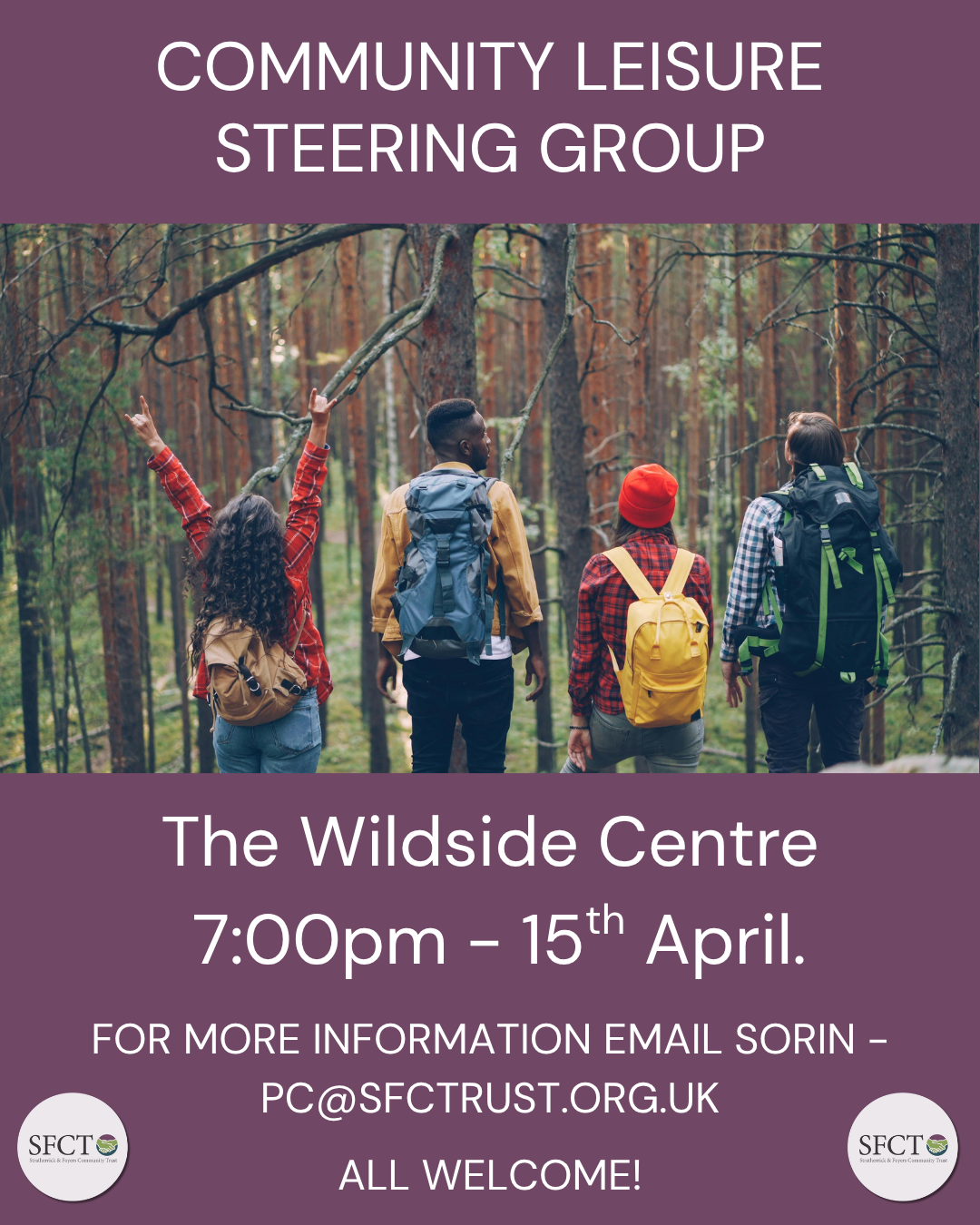 Stratherrick & Foyers Community Trust invites all members of the community to join the Community Leisure Steering Group. This follows the Riverside Field...
 -
8 April
Riverside Community Conversation - Thank you
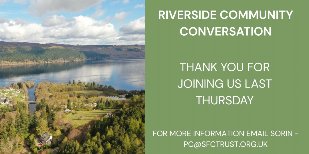 SFCT would like to thank everyone who has supported the conversation around the future of Riverside Field, and especially those who attended the meeting on Thursday 2nd A...
 -
7 April
APRIL MINIBUS TRIPS
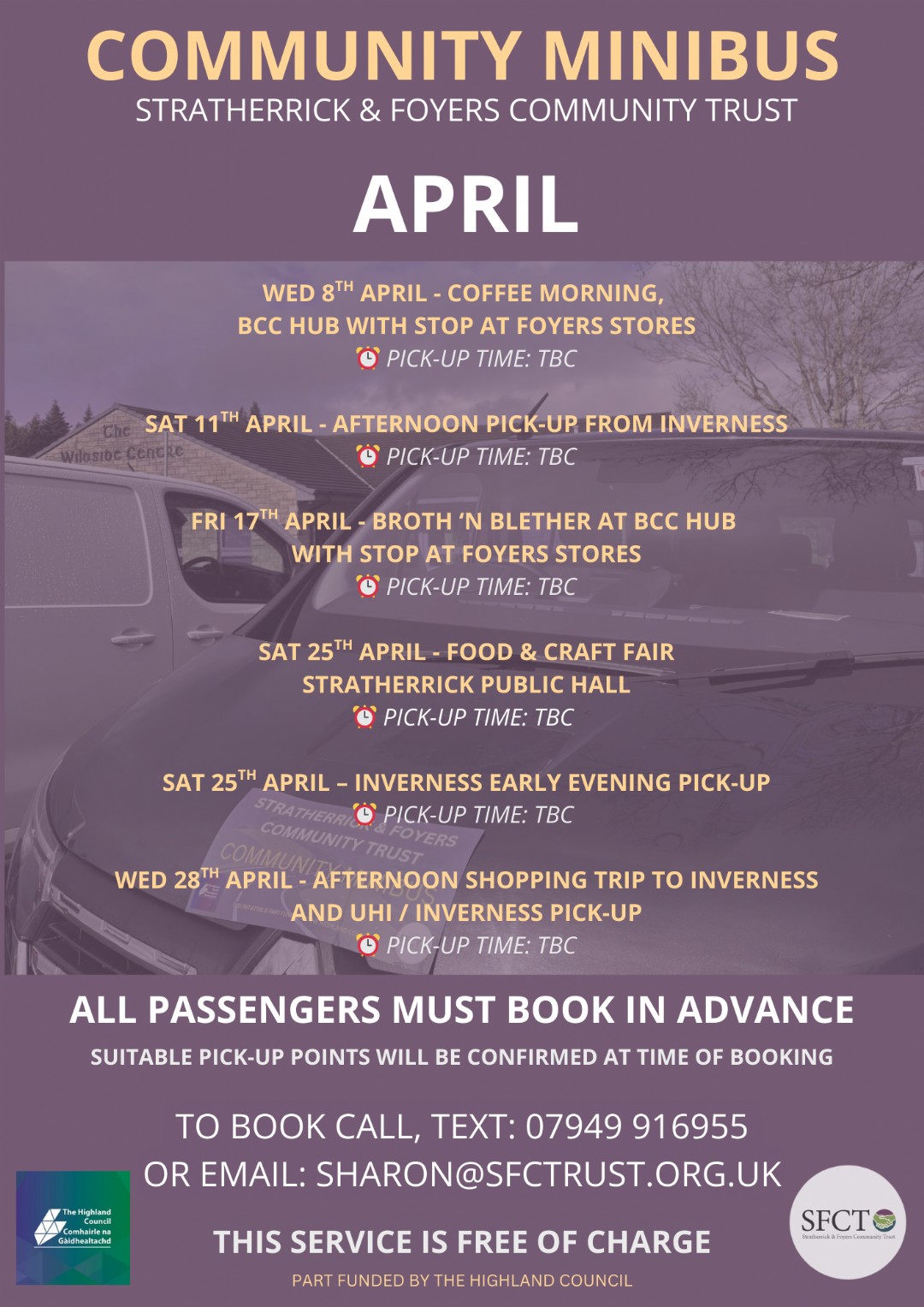 Our brand new community minibus has arrived and we’re so excited to welcome you on board! We’ve got some fantastic trips lined up throughout April — tak...
 -
7 April
Art Group Meeting - Tomorrow at The Hub 7pm
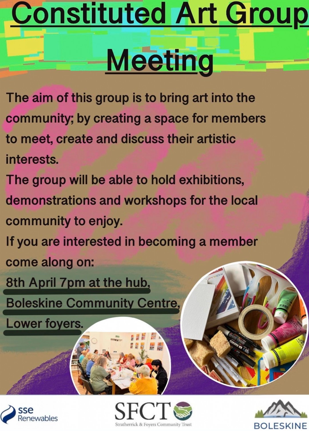 Do you enjoy art? Whether you love crafting, creating, or simply admiring, this could be for you! A new local art group is being set up - a space to share id...
 -
1 April
Statement from our CEO
 The Trust is pleased to announce a new category of grant we offer to support local community groups and individuals, particularly farmers who reside in the area. After le...
 - March (17 stories)
-
31 March
🎻 Traditional Music Session – Everyone Welcome! 🎶
.png) Break out your bodhrán and fine-tune your fiddle! 🎻 Join Kirsteen & Jack at The Wildside Centre on Saturday 4th April from 2pm for a traditional music sess...
Break out your bodhrán and fine-tune your fiddle! 🎻 Join Kirsteen & Jack at The Wildside Centre on Saturday 4th April from 2pm for a traditional music sess... -
31 March
Community Conversation - Riverside Field
 SFCT is keen to re-open discussions around the proposed use and development of Riverside Field. We want to approach this next stage with a practical and collaborative min...
 -
26 March
Highland Musicians stop at The Wildside Centre Tomorrow for Charity Cycle
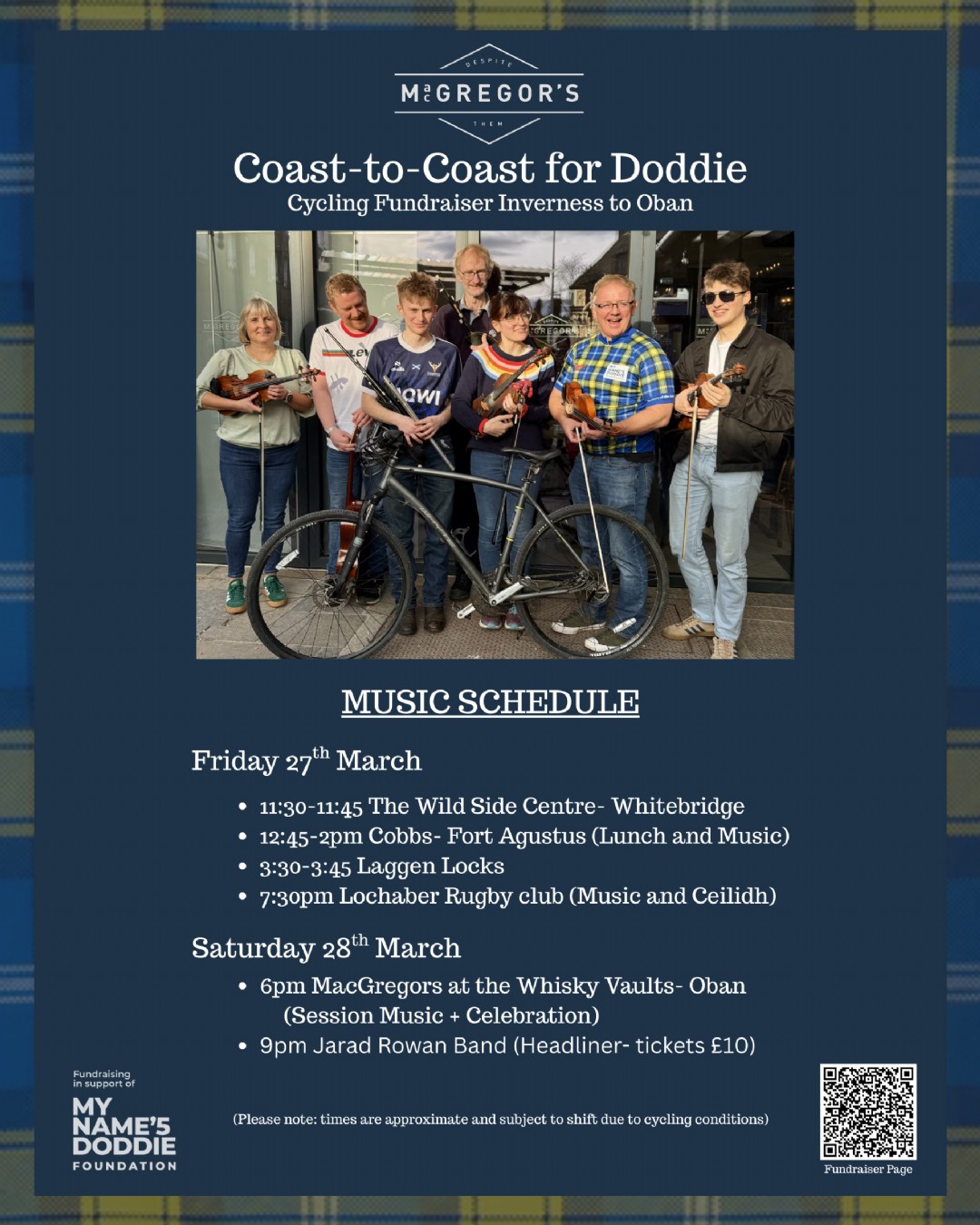 🎻🚴♂️ ONLY 1 DAY TO GO! Highland musicians are gearing up to hit the road this Friday 27th March - cycling Inverness to Oban for the incredible My Name...
 -
25 March
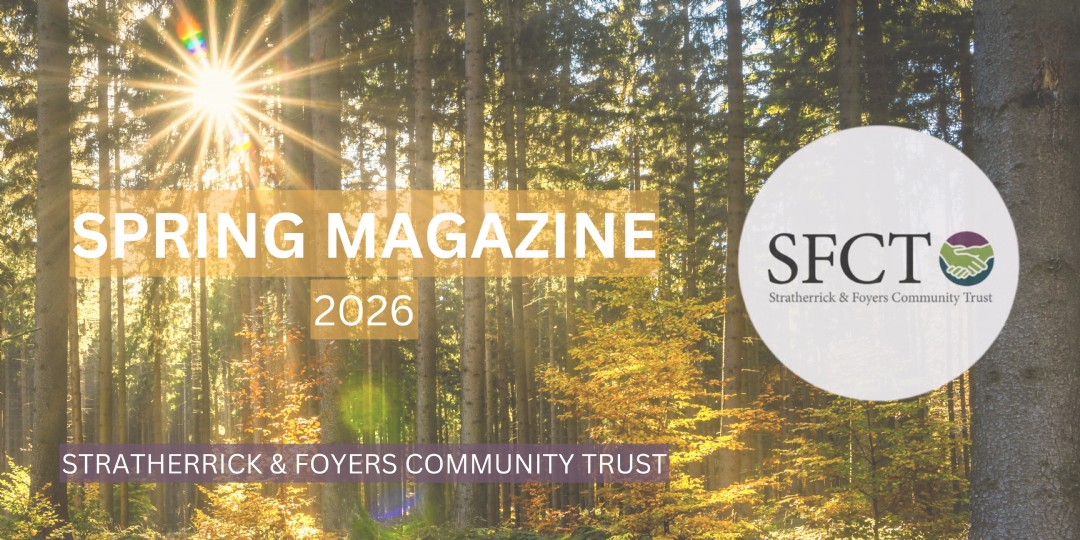
🌱✨ The Spring Magazine Has Arrived! ✨🌱
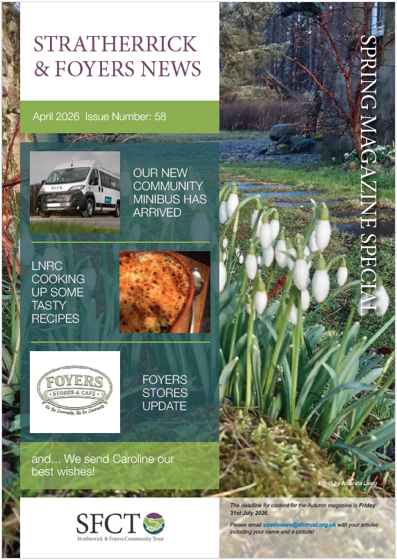 We’re excited to share that the 2026 Spring Magazine from Stratherrick & Foyers Community Trust is now live and ready to view online! Yes, it might...
 -
24 March
🌿✨ BIG NEWS from The Wildside Centre! ✨🌿
 We have officially launched a new Facebook page for the centre - and you’re invited to be part of the adventure! Hit that follow button to keep up with...
 -
23 March
📚 Mobile Library Visiting Tomorrow! 🚐✨
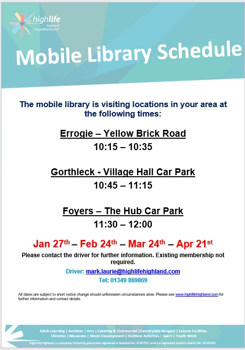 The Mobile Library will be in the area tomorrow morning, so pop along and say hello to Mark! 📍 Stopping points & times: • Errogie – Yellow...
 -
19 March
🎬The Screen Machine is rolling back into Fort Augustus next week!
 Join them from 22nd – 24th March for a fantastic selection of films right on your doorstep. 🍿✨ Check out what’s showing and book your tickets he...
 -
18 March
Join 'Sing In the Strath' next Fri 27th March
 🎭✨ Love musicals? Want to be part of something special this summer? Why not join Sing In The Strath for an informal evening on Friday 27th March from 7:30pm...
 -
18 March
Step aboard the Metagama and set sail on an unforgettable musical journey
 This Saturday (21st March) at Stratherrick Public Hall, experience a powerful live stage show telling the story of 1920s mass emigration from the Hebrides - from Scotland...
 -
17 March
Grants Update
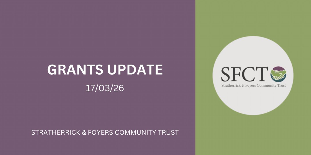 🚨 Don’t miss out! 🚨 There’s still time to apply for our latest round of grant funding - but be quick! The deadline is 21st March ⏳ ...
 -
17 March
Boleskine Biodiversity Group Workshop - This Sat
🌿 Why not head along to Inverfarigaig Forest School this Saturday for a fascinating day in nature? Join the Boleskine Biodiversity Group for a Wildlife Trac...
-
12 March
Highland musicians will set off on a Coast-to-Coast cycle from Inverness to Oban
🎻🚴♂️ The countdown is on! In just a couple of weeks, Highland musicians will set off on a Coast-to-Coast cycle from Inverness to Oban to raise funds f...
-
10 March
🚐 Community Minibus Trips Are Back This March! 🎉
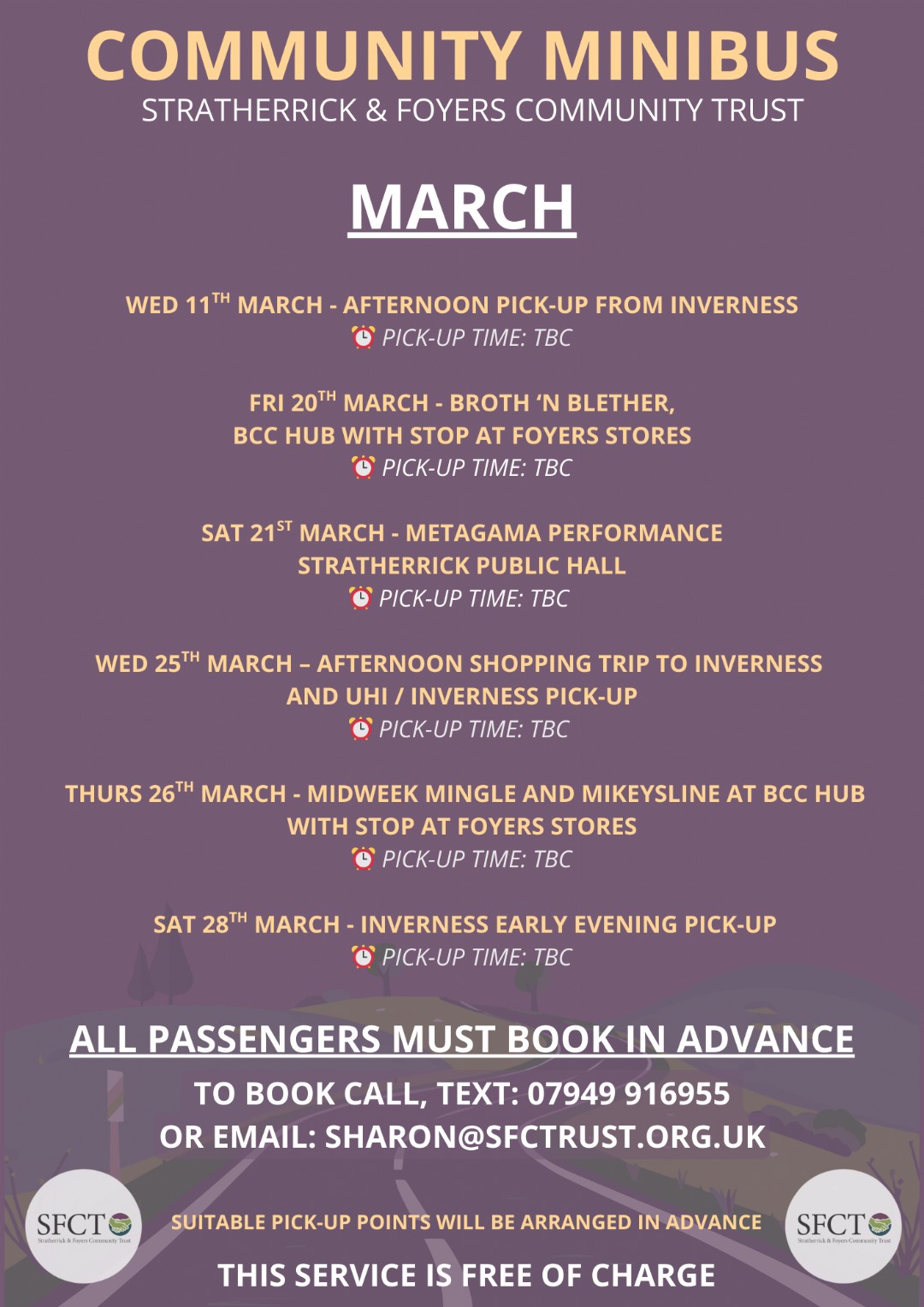 Our minibus service is continuing through March, and we’re so excited to welcome you on board! There are a number of fantastic trips planned throughout...
 -
9 March
✨ Fused Glass Workshop – This Saturday! ✨
 Join the Dizzy Glass Workshop at The Hub on Saturday 14th, 10am–1pm and create your own beautiful fused glass piece. Book your place by emailing anders...
 -
4 March
Forestry & Land Apprentice Opportunity
🌲 We thought we’d share this update from Forestry and Land Scotland, which may be of interest to people in the area. They’re currently recruitin...
-
4 March
⏰ Happening TODAY! ⏰
 Changeworks will be at The Wildside Centre later this morning (4th March) for a FREE drop-in session from 11am–1pm, offering friendly, impartial energy advice. &...
 -
3 March
🚨 JOB FAYRE POSTPONED 🚨
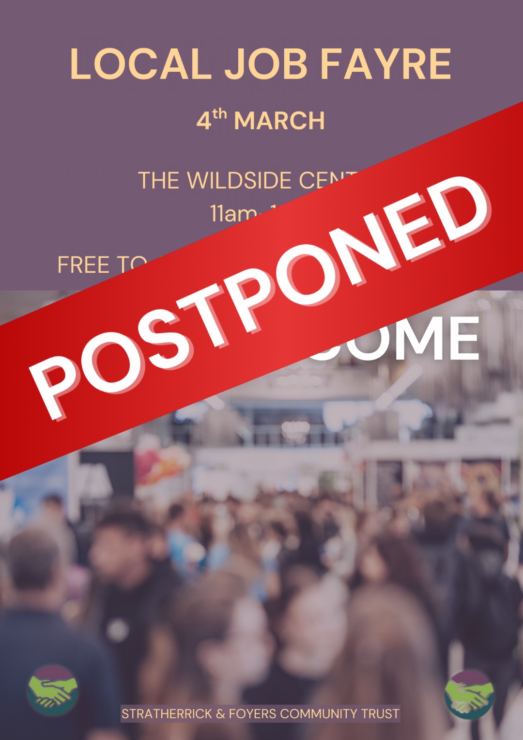 Unfortunately, due to circumstances out with our control, we are sad to announce that we must postpone our Local Jobs Fayre scheduled to take place tomorrow (4th March) a...
 - February (15 stories)
-
25 February
Update regarding transfer of funds to support BCC
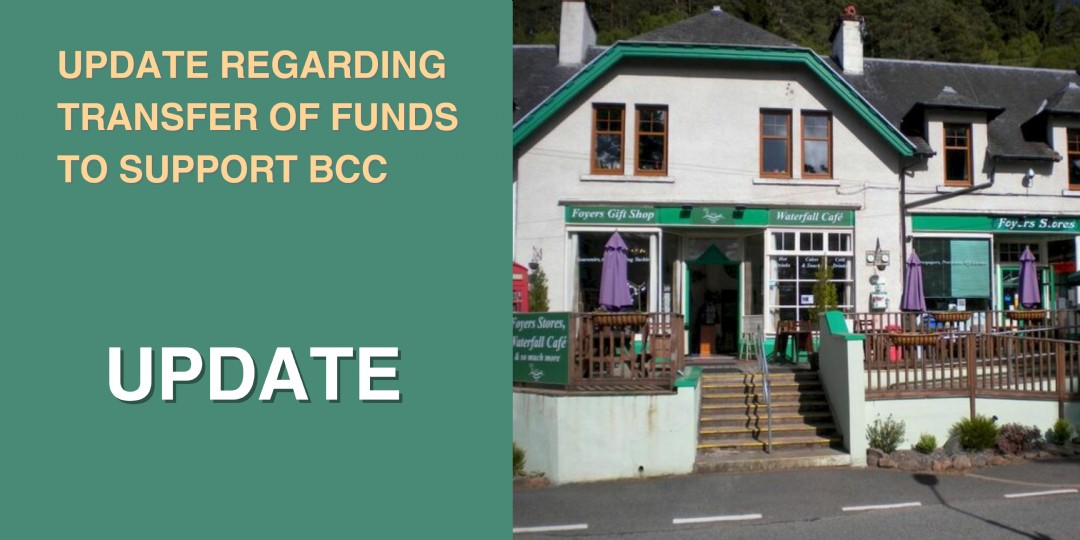 We would like to share a brief update with our community on the progress of transferring funds to support Boleskine Community Care in the purchase of the Foyers Shop and ...
 -
25 February
🚨 NEW EVENT – Local Jobs Fayre at The Wildside Centre! 🚨
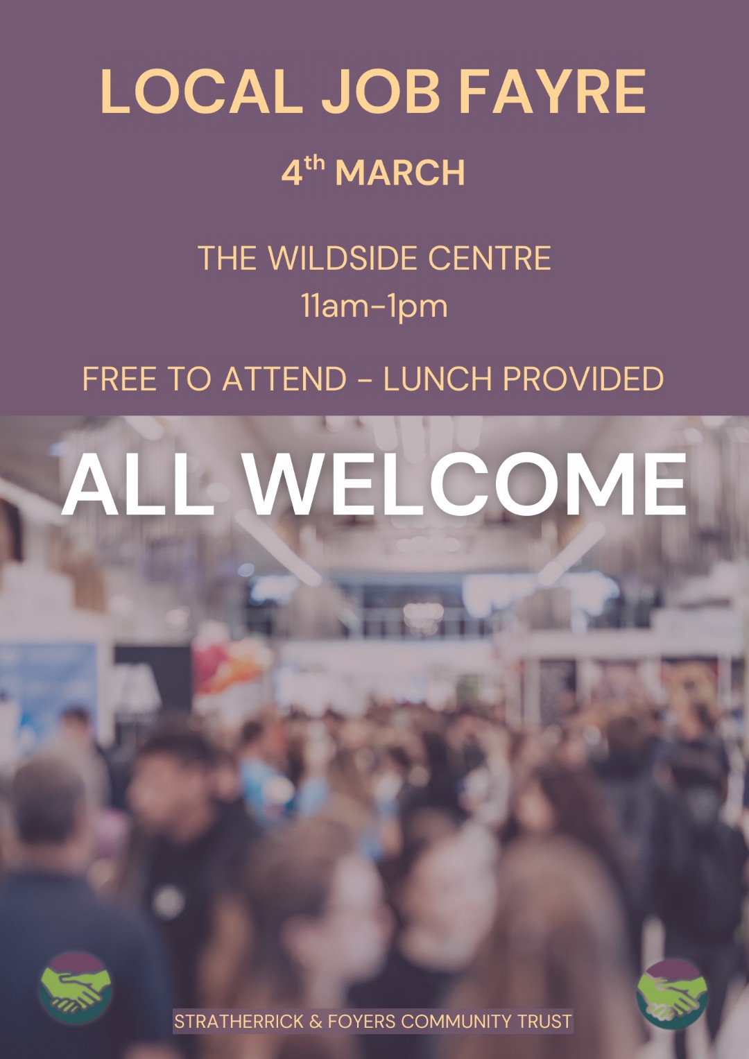 We’re excited to be hosting a Local Jobs Fayre next Wednesday here at The Wildside Centre! 🗓 Next Wednesday - 4th March ⏰ 11am – 1pm 🎟 Free t...
 -
24 February
🌿🌞 Community Support in Action at Stratherrick Nursery! 🌞🌿
 Stratherrick Nursery has recently completed a fantastic new outdoor sandpit, made possible thanks to the generous donations from members of the local community. ...
 -
24 February
Spring Magazine Deadline is Almost Here!
 The deadline to submit content for our upcoming Spring Magazine is this Friday, 27th February! There’s not much time left to get involved! If you have:...
 -
21 February
Step aboard the Metagama and set sail on an unforgettable musical journey ✨
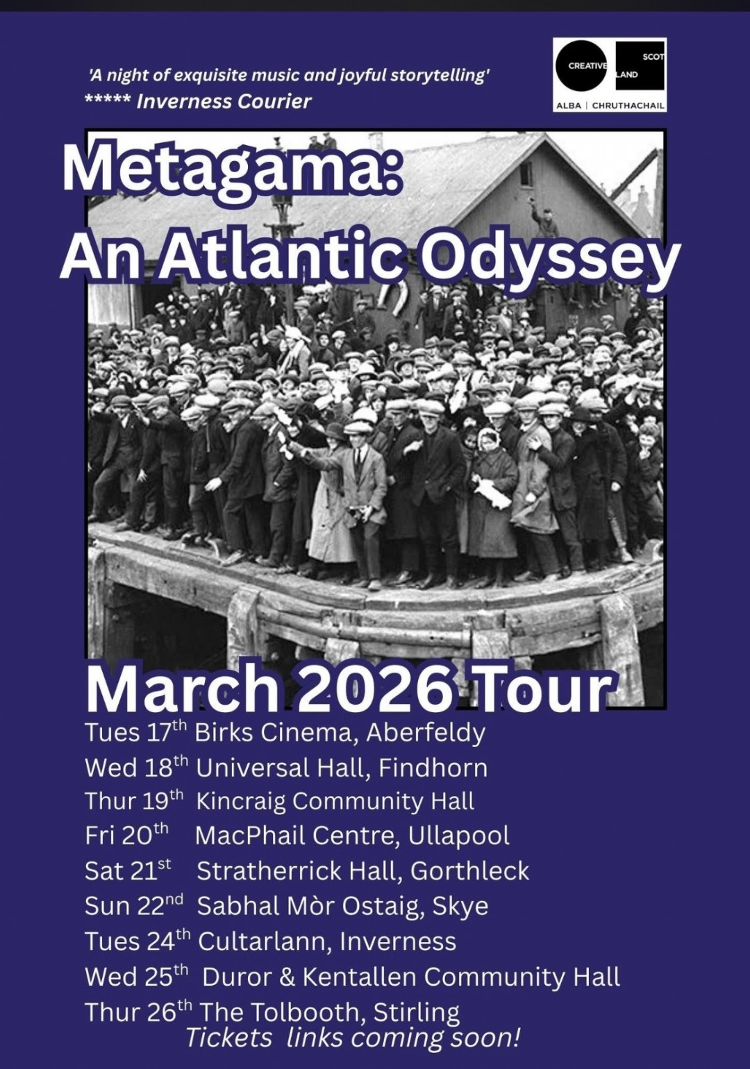 An ensemble of acclaimed musicians and singers bring to life the powerful story of 1920s mass emigration from the Hebrides — travelling from Scotland’s shores...
 -
17 February
Send us your Spring photos
🌸 We’re welcoming spring! 🌸 Our Spring Magazine is on the way, and we’re inviting the community to share your favourite spring-themed photos an...
-
17 February
What a match!
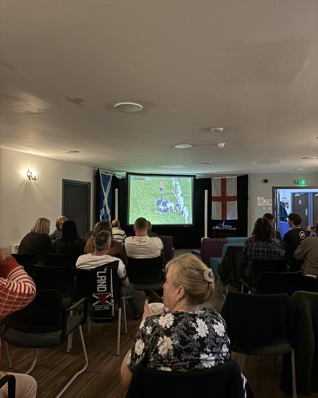 Thanks to those of you who came down to The Wildside to watch the Scotland v England game! What an atmosphere. What do you want to see next? Please sha...
 -
12 February
📢 Calling Local Employers!
 We’re considering hosting a local Jobs Fayre at The Wildside Centre in early March and would love for you to get involved. If you’re currently re...
 -
10 February
Join our Events Committee
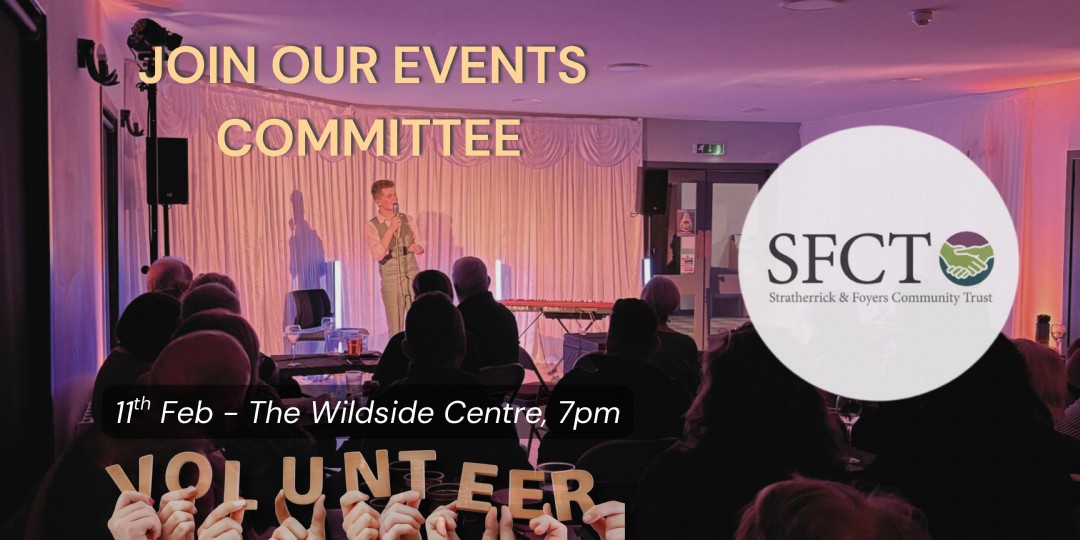 Do you love events? Are you organised, creative, or full of ideas for bringing people together? Would you like to help shape what happens in our community throughou...
 -
10 February
🚐 Community Minibus Service is Back!
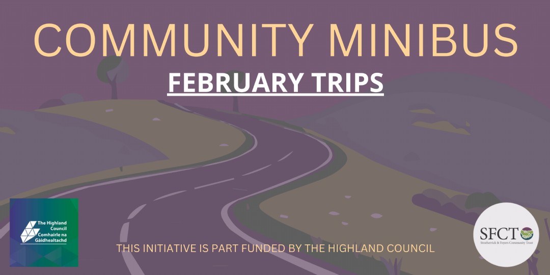 Great news! Our community minibus service is back as of February 🎉 We’ve got a lovely selection of trips lined up for this month, check them out below 👇 &nb...
 -
6 February
🌼 Let Your Words Bloom This Spring 🌼
We are starting to pull together our 2026 Spring Magazine Special, to help do this, we are now looking for fantastic articles to feature! Do you have a story...
-
5 February
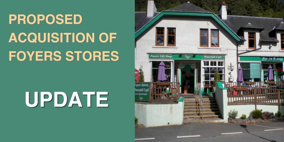
Urgent update regarding the Foyers Stores acquisition
 We are delighted to confirm that following SSE’s approval of the Stratherrick and Foyers Community Trust Board’s recommendation we have approved the grant app...
 -
4 February
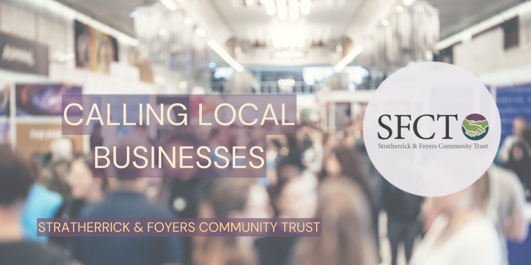
📣 Noticeboard Update!
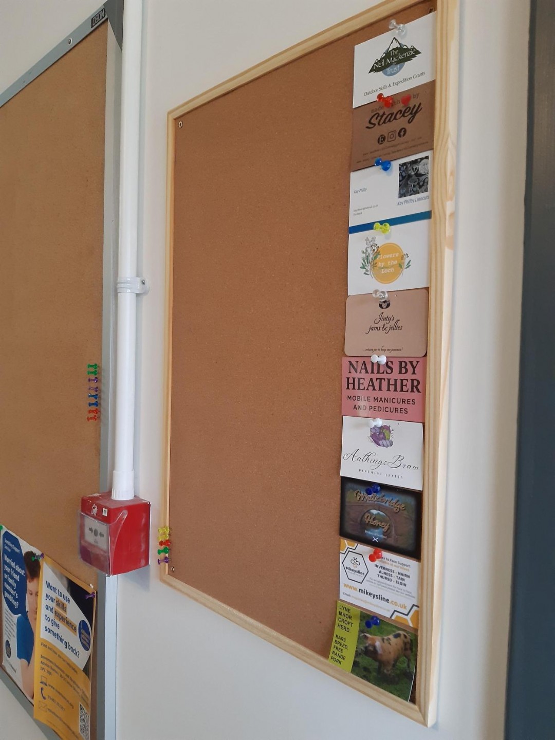 We have recently moved our noticeboard to the reception area within the Wildside Centre! Business cards now have their own dedicated board. If you run a local business...
 -
3 February
📚 Mobile Library Visiting Tomorrow! 🚐✨
 The Mobile Library is rolling into the area tomorrow, Wednesday 4th February, so pop along and say hello to Mark! Stop & time: • The Wildside Centre &ndash...
 -
3 February
RSABI Fundraising Event
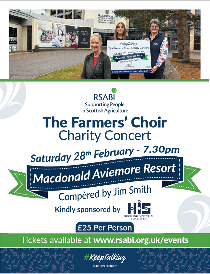 Don't miss out on an incredible evening of music and laughter with the talented Farmers Choir performing in Aviemore late February in aid of RSABI and SAYFC. ...
 - January (12 stories)
-
28 January
Six Nations: Scotland 🆚 England LIVE at The Wildside
 💘 This Valentine’s Day, find someone who loves you as much as you love rugby 🏉 We’re streaming Six Nations: Scotland 🆚 England LIVE at The Wil...
 -
27 January
🌳 Development of Inverfarigaig Forest School 🌳
.jpg) A community member has been in touch about the possibility of setting up a Forest School within our community. With the support of the Community Trust, a short survey has...
A community member has been in touch about the possibility of setting up a Forest School within our community. With the support of the Community Trust, a short survey has... -
26 January
📚 Mobile Library Visiting Tomorrow! 🚐✨
The Mobile Library will be in the area tomorrow, Wednesday 27th January, so pop along and say hello to Mark! 📍 Stopping points & times: • Errogi...
-
22 January
🔥 Free Firewood Available – Whitebridge Area 🔥
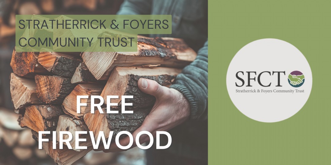 A member of our local community, has been in touch with Stratherrick & Foyers Community Trust (SFCT) to let us know that he has a significant amount of larch firewood...
 -
21 January
Large grant application from BCC for Foyers Stores Acquisition - Update
 A Board meeting is taking place this evening in order for Directors of SFCT to consider the application and agree their recommendation. As the Chair of SFCT explained at ...
 -
20 January
Thank you!
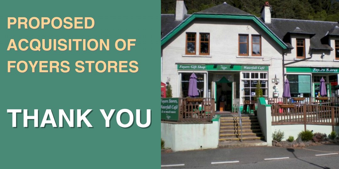 Thank you to everyone who came along to the public meeting at the Wildside last night. We had a fantastic turnout, with 110 people attending in person and 26 joining u...
 -
19 January
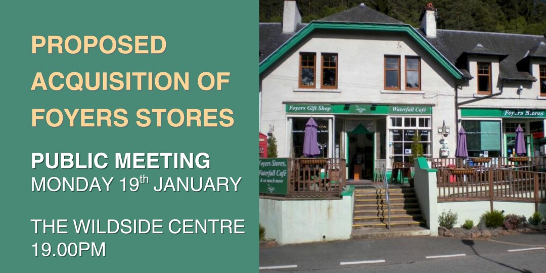
Agenda for Public Meeting - Regarding the Foyers Stores Acquisition
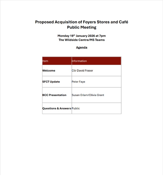 Please find the agenda for tonight’s public meeting at the Wildside Centre regarding the proposed community acquisition of Foyers Stores. 1. Welcome &n...
 -
14 January
Apply for our Project Coordinator role
 👋 Friendly reminder! There’s still time to apply for our Project Coordinator role at Stratherrick and Foyers Community Trust ...
 -
8 January
Notice to the Community: Change of Date for Public Meeting on Foyers Stores
 Stratherrick and Foyers Community Trust (SFCT) would like to update the community regarding the previously announced public meeting relating to the proposed purchase of F...
 -
7 January
🌟 New Year, New Opportunities! 🌟
 Stratherrick & Foyers Community Trust is here to support your projects with our grants! 💡✨ 📅 Next application deadline: 21st March 2026 Learn more about ...
 -
6 January
🎉 Calling all community organisers! 🎉
 Do you run a class, group or one-off activity in one of the local buildings? We’d love to help spread the word! 💛 Our SFCT Community Calendar is looking a ...
 -
6 January
Mobile Library Visit Cancelled – Wednesday 7th January 2026
👋 Hello and welcome to 2026 from SFCT! 🎉 We bring news from the Mobile Library as our first update of the year. 📚 Mobile Library Visit Cancelled – Wednesday ...


The Wildside Centre, Whitebridge,
Inverness IV2 6UN
admin@sfctrust.org.uk
07300 562443